


About Metrika360Buildings measured properly, by people who do this for a living.
We document existing buildings — offices, plants, hospitals, warehouses, landmarks — and hand over the drawings, models and data that projects get built on. Nothing else. It is a narrow thing to do well, and we have been doing it long enough to know where it goes wrong.
How we workFour things we do not compromise on.
-
The survey is evidence
Every drawing traces back to a measured point. When a dimension is questioned six months later, the answer comes from the cloud, not from anyone’s recollection.
-
Three people, not one
Whoever captures the building does not model it, and neither reviews it. Slower than the alternative, and the reason our deviation figures hold up.
-
Your standard, not ours
Layer naming, families, title blocks. The file drops into your project instead of starting a reformatting job.
-
Method chosen per area
Terrestrial where tolerances matter, mobile where they do not, drone where a tripod cannot reach. Per building, not per project.


Engineering background
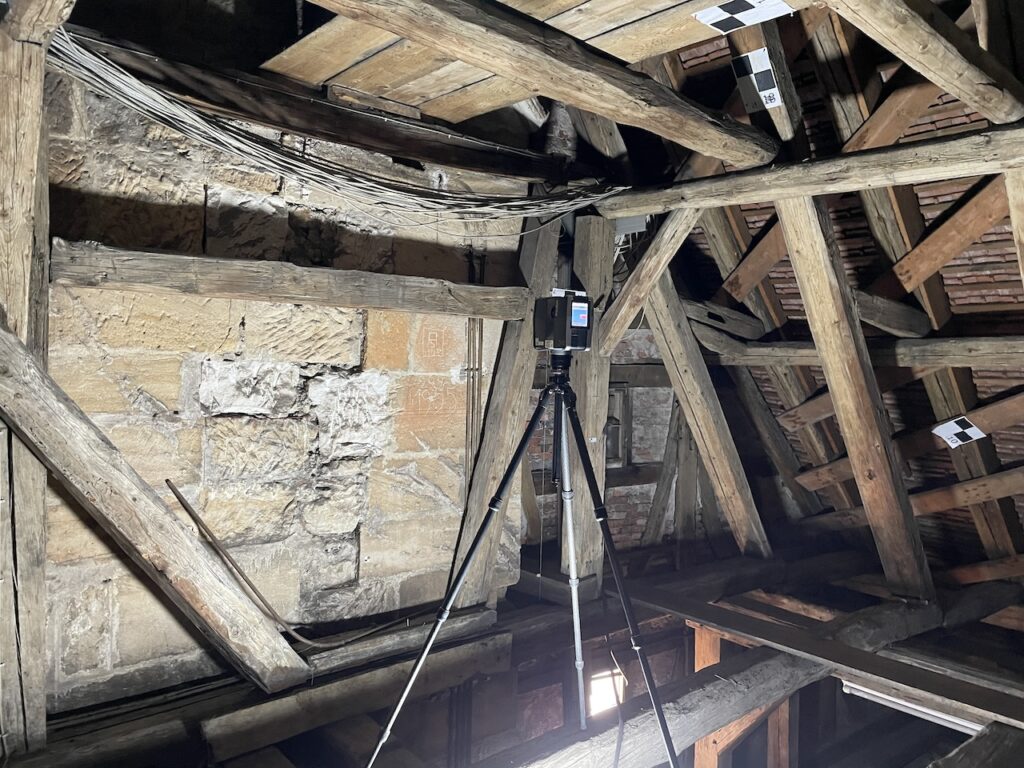
Metrika360 was built by surveying engineers and BIM specialists, not by a photography or marketing business that added scanning later. That shows up in unglamorous places: how control is established, how registration is verified, what happens when a scan does not tie out.
The company operates out of Austin and New York and works across the United States. Our European engineering practice is where the method came from — the standards work, the quality process, the insistence on documenting accuracy rather than claiming it, which in the US means stating a USIBD Level of Accuracy.
What we work on
Adaptive reuse and renovation · tenant fit-out · due diligence before acquisition · industrial plants and manufacturing · hospitals and laboratories · landmarked and historic structures · warehouses and distribution centers · portfolio-wide documentation programs.
The projects that suit us best are the ones where being wrong is expensive: occupied buildings, tight tolerances, structures nobody has a reliable drawing of. Who commissions this work, and why, is on the clients page.




The method, in the order it happens
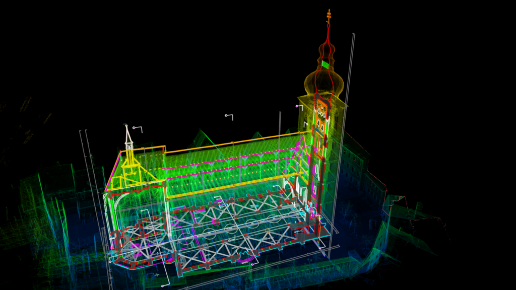
Control first. Reference points are established before a single scan is taken. Everything measured afterwards is tied to them, and control cannot be added retrospectively. This is the step that separates a survey from a collection of scans.
Capture per area. Terrestrial where a tolerance will be built against, mobile where floor area is the problem, drone where a tripod cannot reach. Chosen per area rather than per project, because a building scanned entirely at the highest accuracy costs several times what it needed.
Registration, then verification. Scans are tied into one coordinate system, loop closure is measured rather than assumed, and the deviation figure is recorded for your project. Nothing is drawn from an unverified cloud.
Production and review. Drawings and models are produced to your standard by one person and reviewed by another. Slower than the alternative, and the reason the deviation figures hold up.
Handover with the evidence. Deliverables plus the registered cloud, the registration report and a record of which method covered which area. A survey you cannot audit is an opinion.
What we work with
| Instrument or tool | Where it is used |
|---|---|
| Faro Focus, terrestrial scanner | Structure, plant rooms, risers, facades. Millimeter-accurate, deviation held under 0.4 in across a registered project. |
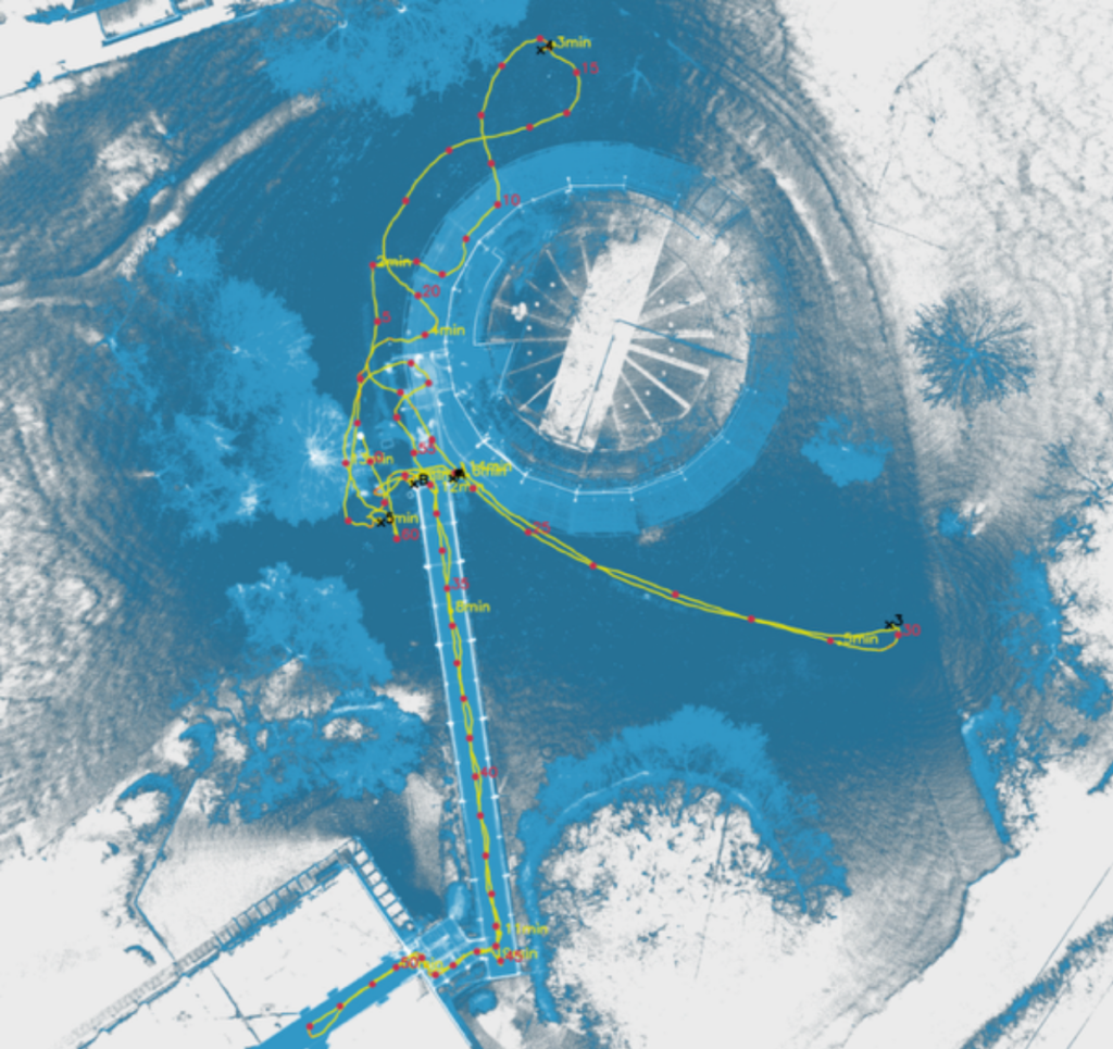
| NavVis VLX, mobile mapping | Floor plates, circulation, warehouses. Up to 107,000 sq ft per day in open industrial space. |
| DJI platforms with GNSS control | Roofs, upper facades, sites. Always flown against ground control. |
| Revit, AutoCAD, Navisworks | Modeling and drafting, in your families and naming conventions rather than ours. |
| E57, RCP, DWG, DXF, RVT, IFC | Delivery. Vendor-neutral by default, because the software you run today is not necessarily the one you run in five years. |
Standards, and how we state them
Accuracy is a specification, not an adjective. Where a project cites a USIBD Level of Accuracy, we confirm in writing which level applies to which area before mobilizing, and we separate what was measured from what was represented in the deliverable. Where a project cites nothing, we still record method, control and verified deviation, because a figure nobody can check is worth nothing to either side.
Drawing standards are yours. Layer naming, line weights, title blocks, dimension styles and abbreviation conventions come from your office template. Where there is no written standard we deliver ours as a document, so the next consultant on the project has something to follow rather than a fourth convention to reconcile.
The engineering practice this method came out of is European. What travelled is the process: how control is established, how registration is verified, and what happens when a scan does not tie out. The vocabulary on this site is the US one, which is why you will find USIBD Level of Accuracy here and no European standards cited.
What we do not do
- We do not sell software. There is no platform to steer you toward, which is exactly why the data is vendor-neutral. That is a business model, not a disclaimer.
- We do not survey boundaries. Parcels, easements and topographic survey for permit belong to a licensed land surveyor. We document buildings.
- We do not assess structures. We measure movement and present deviation. Whether it is acceptable is a structural engineer’s judgement, and we work alongside yours.
- We do not subcontract the modeling. It is done in-house, by people who can be asked why an element sits where it does.
- We do not quote what we cannot deliver. If the work is outside what we do well, that comes back in the first reply rather than after the invoice.
Frequently asked questions
Where are you based?
Austin, Texas and New York City, working across the United States. For multi-site programs we mobilize from whichever base is closer to each building.
How large a project can you take?
We have documented single floors and half-million-square-foot facilities. Scale is rarely the constraint — access usually is. What it costs is on the pricing page.
Do you subcontract the modeling?
Modeling is done in-house, to your standard, by people who can be asked why an element sits where it does.
What do you not do?
We do not sell software and have no platform to steer you toward. The data we produce is vendor-neutral because we have no reason for it not to be.
Talk to someone who was on site
Tell us about the building and we will tell you how we would measure it.