


Deformation monitoringHow far it has moved — and whether it still is.
Buildings settle, deflect and lean. Most of the time it does not matter. When it does, the question is never “is it perfectly straight” — it is “how far off is it, and is that number changing”.
Two different questions
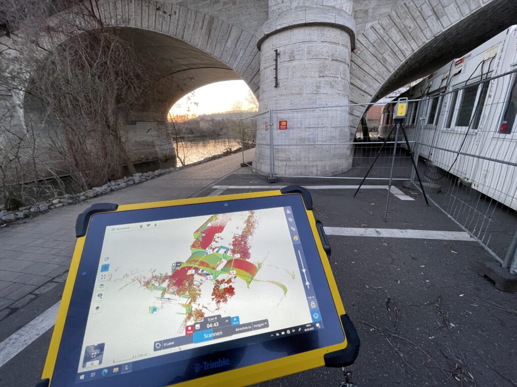
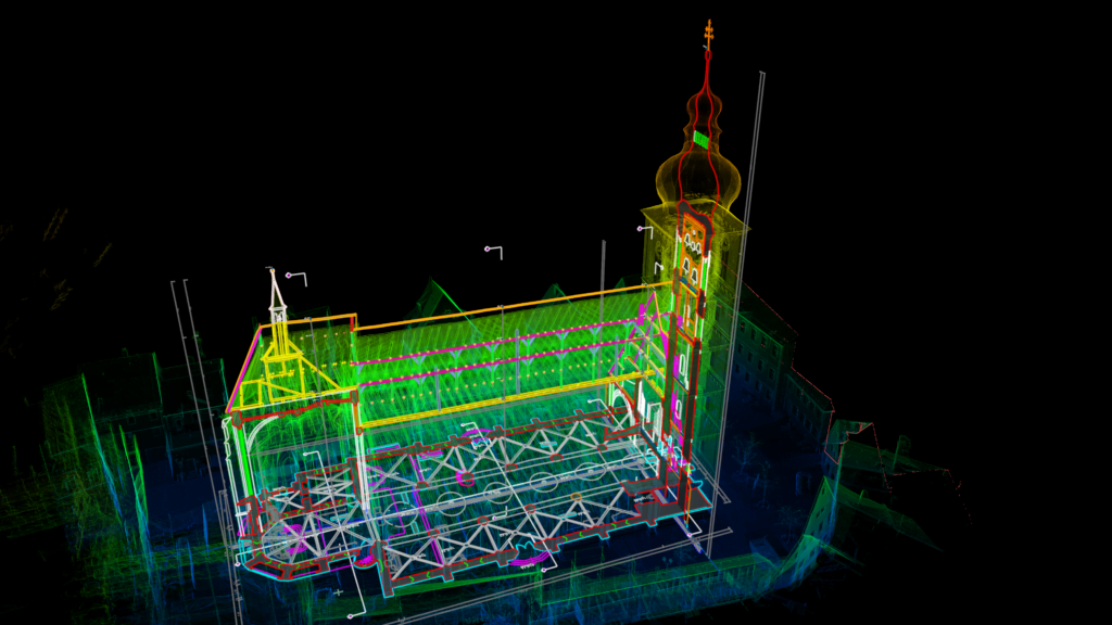
How far from true is it now? A single survey answers this. We measure the structure as it stands and compare it against design intent, level, or plumb. Where the comparison has to run against drawings rather than a datum, those come from an as-built survey. The output is a deviation map: where the floor dishes, where the facade leans, by how much, over what distance.
Is it still moving? This needs repeat surveys from the same control, compared over time. Movement between epochs is the signal — a single survey cannot give it to you, however accurate it is.
Getting that distinction right at briefing matters, because the second question requires stable control established on the first visit. Retrofitting it later restarts the time series from zero.
Typical triggers
- Visible cracking, or a door that has stopped closing
- Excavation or piling on an adjacent site
- Change of use adding load to an existing floor
- Historic timber and masonry structures under assessment
- Condition record before adjacent construction begins, often alongside a virtual tour
Method
Terrestrial laser scanning from fixed control positions. Millimeter-accurate, and — more important for monitoring — repeatable, so the comparison between epochs measures the building rather than the setup. Mobile mapping is the wrong tool here: it is dimensionally accurate rather than millimeter-accurate, and its tracking error moves with the operator.
What the measurement is compared against
A deviation figure means nothing without its reference. Three are in common use, they answer different questions, and mixing them is how monitoring reports become unusable.
| Reference | Question it answers | What you need for it |
|---|---|---|
| Design intent | How far from the drawing is it built or has it moved since. | A drawing set worth comparing against. Where none exists, an as-built drawings set comes first. |
| Level or plumb | How far off horizontal or vertical is it now. | One survey. No history required, which makes this the fastest useful answer. |
| A previous epoch | Is it still moving, how fast, and where. | Stable control established on the first visit and reoccupied on every later one. |
The third row is the one that cannot be retrofitted. Without control from the first survey, a later comparison measures the setup as much as the building, and the time series restarts from zero.
How a monitoring program is set up
-
Threshold
What movement would change your decision, and who acts on it. Agreed with the engineer assessing the structure before anyone is on site.
-
Control, first visit
Reference points established outside the affected zone. Everything afterwards is measured against them, and this step cannot be added later.
-
Baseline survey
The structure as it stands today, terrestrial from fixed positions. Millimeter-accurate, and repeatable, which matters more than accuracy alone for monitoring.
-
Epochs at the agreed interval
Weekly during adjacent excavation, quarterly or annual for long-term settlement. Same positions, same method, comparable conditions.
-
Deviation report per epoch
Colour-mapped surface, sections through the areas of interest, numbers at the points that matter, and the registered cloud for the epoch.
What we are usually called for
Adjacent excavation and piling
The most common trigger, and the one with the tightest schedule. A baseline before ground is broken, then repeat epochs at the interval the engineer sets. The baseline is worth more than any later refinement: without it, every subsequent reading is an assertion rather than a comparison.
Historic masonry and timber
Structures that have been moving for a century and mostly stopped. The question is rarely whether they are plumb, because they are not, but whether the movement is historic or current. That needs epochs spaced far enough apart to separate seasonal movement from progressive movement.
Industrial floor slabs
Flatness and settlement under racking, machinery and traffic. The deliverable here is usually a colour-mapped surface rather than points, because what matters is the shape of the dish rather than any single number in it.
Facades and curtain wall
Bowing, differential settlement and out-of-plane movement, measured from fixed positions on the ground or flown where the elevation is out of reach. This is where a survey most often ends up in a dispute file, which is why the method record travels with the numbers.

What makes a monitoring program useless
- Control that moved. If a reference point sits on the structure being monitored, or on something disturbed between visits, the comparison measures the reference. Control is set outside the affected zone and checked at every epoch.
- Thermal movement read as settlement. Buildings expand and contract. Epochs captured at very different temperatures or times of day will differ for reasons that have nothing to do with the structure. We record conditions with the survey and keep the timing consistent.
- Comparing against an incompatible survey. An older survey from unknown control or in an incompatible format cannot be the baseline, however good it looked. Where that is the case we say so and start the series today, which is still better than starting it next year.
- Epochs too far apart. Movement that matters can happen between quarterly visits during active excavation. The interval belongs to the engineer assessing the structure, and we execute it consistently rather than improving on it.
- A number without a threshold. Deviation is only actionable against a limit agreed in advance. We ask what movement would change your decision before the first survey rather than after the third.
Where our work stops
- We measure and present deviation. Whether it is acceptable is a structural engineer’s judgement, and we work alongside yours rather than in place of them.
- If the building has never been documented, an existing conditions survey usually comes first. Monitoring an undocumented structure produces movement figures nobody can place.
- If the question is what the building looks like rather than where it has moved, that is a virtual tour.
- Continuous instrumented monitoring with sensors and alarms is a different discipline from periodic survey. Where a project needs alerts in hours rather than a report per epoch, we will say so.
Frequently asked questions
What do we receive?
A deviation analysis showing measured position against reference — as a colour-mapped surface and as numbers at the points that matter — plus sections through the areas of interest and the registered point cloud for each epoch.
Can this be used in a dispute?
A dated, registered survey is defensible evidence of condition on a given date. That is a large part of why clients commission one before adjacent construction starts.
How small a movement can you detect?
Terrestrial scanning resolves millimeter-scale geometry. What is reliably detectable between two epochs depends on the control and on site conditions, which is why we agree the threshold that matters to you before the first survey rather than afterwards. Stating it as a level of accuracy rather than as an adjective is the point.
How often should surveys be repeated?
It depends on what is driving the movement. Adjacent excavation might warrant weekly; long-term settlement monitoring is often quarterly or annual. The engineer assessing the structure should set the interval — we execute it consistently.
Can you compare against an older survey?
Only if it was captured from usable control and in a compatible format. Where it was not, the first survey becomes the baseline — which is still considerably better done today than in a year.
Do you assess the structure yourselves?
No. We measure and present deviation. Interpreting whether it is acceptable is a structural engineer’s call, and we work alongside yours rather than in place of them.
Something has moved?
Tell us what you are seeing and what is driving it. We will tell you whether one survey answers it or whether you need a baseline. Day rates and project bands are on the pricing page.
Our deliverables document existing physical conditions. They are not a boundary survey, a land title survey, or an ALTA/NSPS Land Title Survey, and they are not to be used in lieu of a survey prepared by a land surveyor licensed in the state where the property is located. Where a project requires boundary, topographic, or georeferenced survey data, we work from control provided by your licensed surveyor.