


Laser scanning servicesMeasure the building once. Measure it properly.
We capture buildings, plants and infrastructure with terrestrial laser scanners, mobile mapping systems and drones — and hand over a registered point cloud your team can work from for years. The end-to-end version, capture through drawings, is an existing conditions survey.
Detail at scale
What 0.4 inches looks like
Registered deviation on terrestrial work stays under 0.4 inches across the project. Set a dimension you actually build against, then magnify the joint until the figure becomes visible. On most buildings you have to zoom a long way.
Detail A 1 : 1
At 1:1 the envelope is thinner than one pixel. Magnify to make it appear.
1 : 3,600
- Move the slider to see the arithmetic.
The 0.4 inch figure is project-wide on a registered terrestrial survey, not a per-foot drift. Mobile mapping is dimensionally accurate rather than millimeter-accurate, which is a different figure and a deliberate trade.
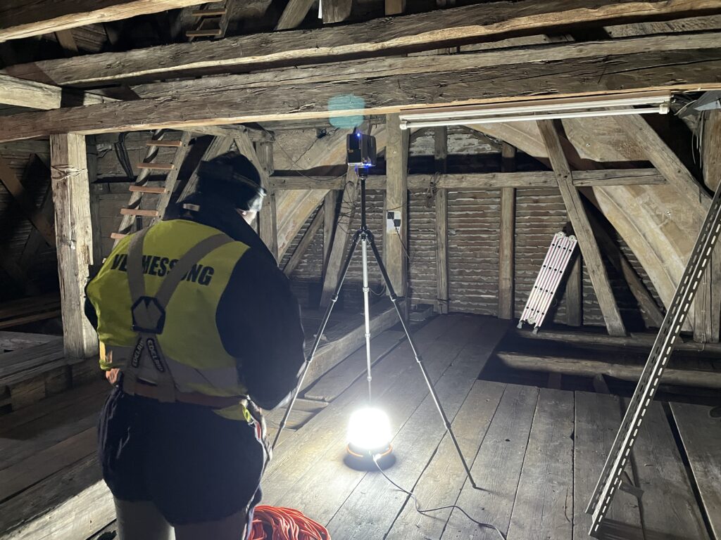
Terrestrial laser scanning
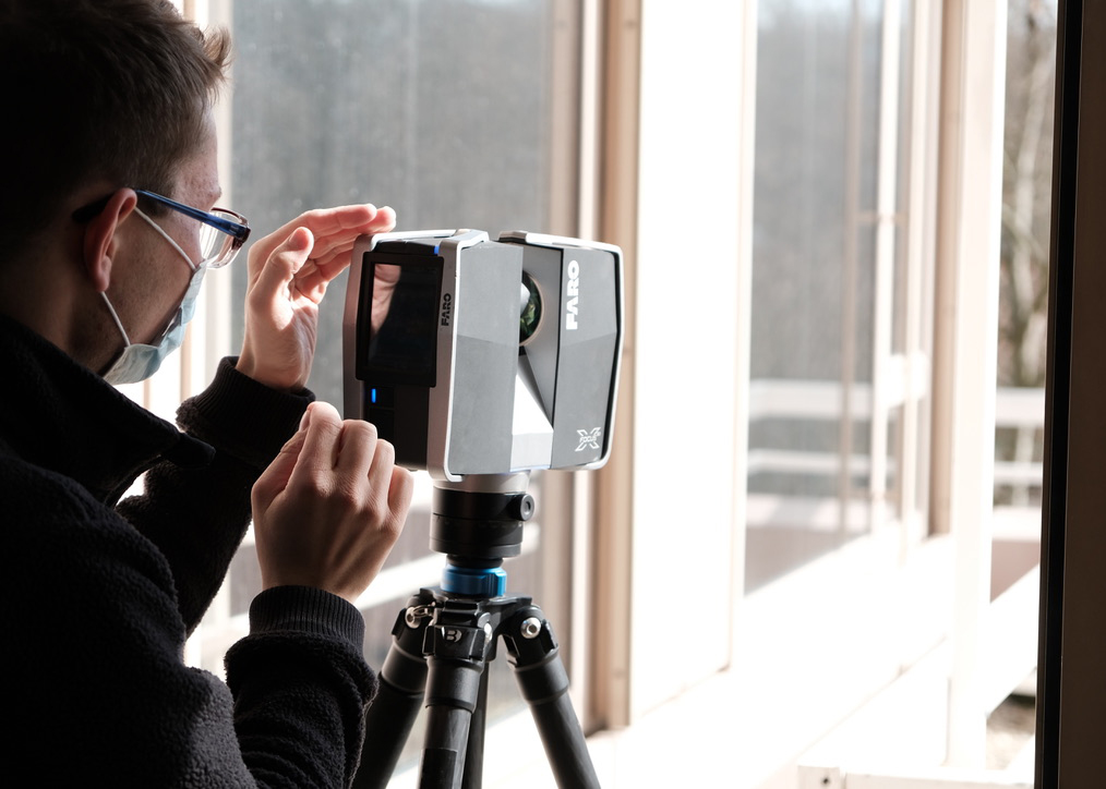
The precise one. The scanner sits on a tripod and measures everything in view — millions of points per position, each one a real distance rather than an inference, LiDAR in its most controlled form. It works in the dark, it does not care whether a wall has texture, and it is what we use wherever a tolerance will be built against.
Structure, mechanical rooms, facades, ceiling voids, anything where being an inch out has consequences downstream. Millimeter-accurate, and slow enough that we choose where to spend it.
Equipment: Faro Focus.
Mobile mapping
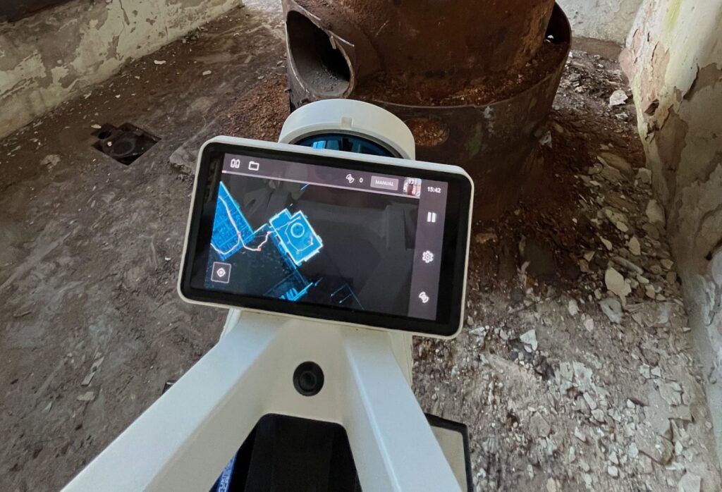
The fast one. Carried through the building at walking pace, it covers very large floor areas in a fraction of the time a tripod would need. The trade is precision: mobile mapping is dimensionally accurate rather than millimeter-accurate.
That makes it right for circulation, warehouses, portfolio documentation and anywhere the question is “where is everything” rather than “exactly how far apart”. It is wrong for a steel connection, and we will say so rather than quietly using it everywhere because it is cheaper.
Equipment: NavVis VLX.
Drone capture
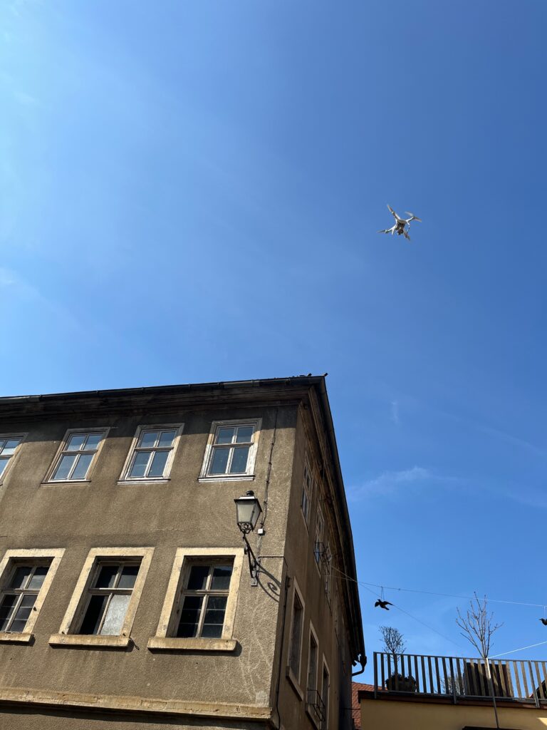
Reaches what a tripod cannot: roofs, upper facades, large sites. Scope, airspace and weather are covered on the drone surveys page. Flown against ground control and registered into the same coordinate system as everything measured from the ground, so the roof sits above the floor plan in the right place.
In controlled airspace, authorization is usually the longest lead time on the whole project — worth raising the address early. Aerial capture is photogrammetric rather than laser-measured, a difference set out in laser scanning vs. photogrammetry.
Equipment: DJI platforms, GNSS control.
Quality control is the part you are paying for
Anyone can put a scanner on a tripod. The difference between a usable survey and an expensive folder of data is what happens afterwards.
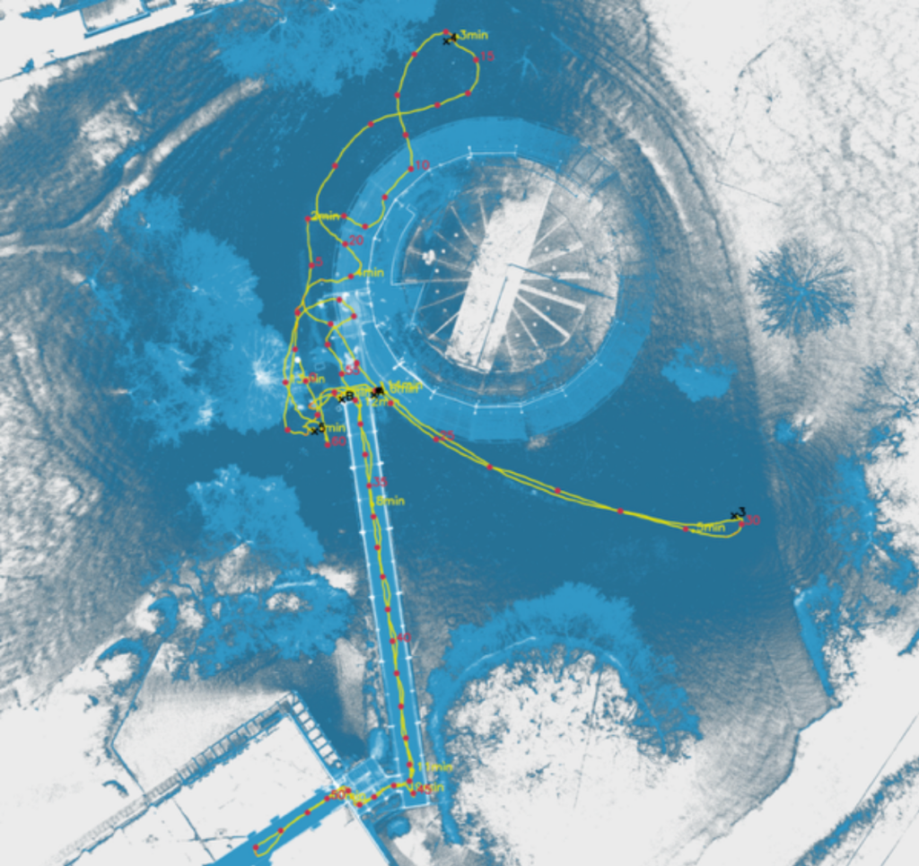
Registration is verified before anything is drawn — scan positions are checked against each other, and loop closure is measured rather than assumed. The person who captures the building is not the person who models it, and neither is the person who reviews it.
That process is why we can state a deviation figure at all. Most of this industry does not.
Surfaces that fight back
A laser scanner measures whatever returns the pulse. Five material conditions do not return it honestly, and all five are predictable enough to plan around rather than discover during registration.
- Glazing. The pulse passes through and returns from whatever is behind it. A curtain wall scanned only from inside produces an envelope that is not there. We capture glazed elevations from both sides, or from the ground with the drone covering the upper storeys.
- Mirrors and polished metal. The reflection is measured as if it were geometry, which puts a copy of the room behind the wall. Reflective surfaces are noted on site so registration can strip them instead of the modeler inheriting them.
- Matt black and deep textiles. Very little energy comes back, so points thin out. Black rubber flooring, acoustic panels and dark ductwork need closer setups rather than more passes from the same position.
- Wet floors and steam. Standing water reflects, steam scatters. In washdown areas and plant rooms capture is scheduled around cleaning cycles, which costs an hour of planning and saves a return visit.
- Repeating geometry. Identical bays, long corridors and empty racking give registration too little to distinguish one position from the next. These runs are tied to control targets rather than to shape alone.
A day on site, in order
-
Control, 30 to 60 minutes
Targets and control positions are set before a single scan is taken. Everything that follows is measured against them, and retrofitting control is not possible.
-
Capture, the rest of the day
32,000 to 65,000 sq ft in offices, up to 107,000 sq ft in open industrial space, far less in dense mechanical areas. Method is chosen per area, not per building.
-
Field check, 30 minutes
Positions are registered provisionally before the crew leaves the building. A gap found on site costs an hour. The same gap found in the office costs a return visit.
-
Registration, 1 to 3 days
Scans are tied into one coordinate system and loop closure is measured rather than assumed. Deviation is reported for your project, not quoted from a brochure.
-
Handover, same week
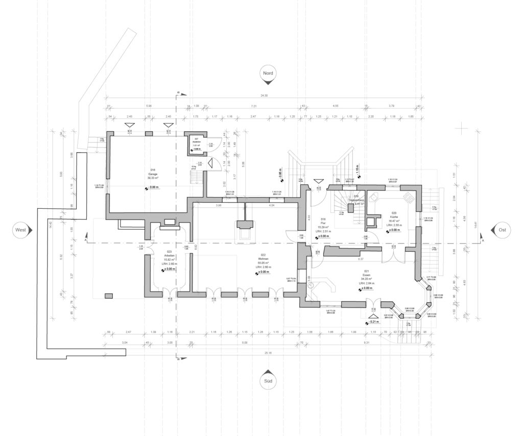
Registered cloud in E57 and RCP, viewer link, registration report. Drawings and models follow on their own schedule.
What lands in the handover
Every project, regardless of what else was ordered:
| Item | Format | What it is for |
|---|---|---|
| Registered point cloud | .e57, .rcp |
The measurement itself. Opens in Revit, AutoCAD, Navisworks and most reality capture software. |
| Browser viewer | Hosted link | For the people on the project without that software installed. |
| Registration report | .pdf |
Scan positions, loop closure, measured deviation. The evidence behind the accuracy figure. |
| Method record | .pdf |
Which method covered which area, and which areas stayed occluded. |
| Control schedule | .pdf, .csv |
Where control sat, so a later survey can tie into the same coordinate system. |
Drawings, models and walkthroughs are ordered on top of this, never instead of it. Rates for each are on the pricing page.
When a laser scan is not the answer
- One room, one question. If the project needs three dimensions checked, a tape and an hour beat mobilizing a crew. Our minimum project is $2,500 and we will say when it is not worth spending.
- Marketing a space. If nobody will build against the data, a virtual tour answers it at a fraction of the cost.
- Boundaries and topography. That is a licensed land surveyor’s work. Buildings are ours.
- Movement over time. A single scan cannot tell you whether something is still moving, however accurate it is. That needs deformation monitoring from stable control.
Frequently asked questions
What does a 3D scanning service actually deliver?
At minimum, a registered point cloud — the measured survey itself. Most clients then take as-built drawings, a Revit model, or both, produced from that cloud.
How accurate is 3D laser scanning?
Terrestrial scanning is millimeter-accurate; we hold deviation under 0.4 inches across a registered project. Mobile mapping is dimensionally accurate rather than millimeter-accurate — a deliberate trade for speed over very large areas.
Do you need to shut the building down?
Almost never. Scanning works around occupancy. Where a space genuinely has to be empty, we schedule outside business hours.
How soon can you be on site?
Which method will you use on my building?
Usually two of the three. A typical office project is terrestrial in the plant rooms and risers, mobile mapping across the floor plates, drone on the roof. Choosing per area rather than per project is the single biggest lever on both cost and quality — a building scanned entirely at the highest accuracy costs several times what it needs to. The pricing page shows what that does to the number.
What do you scan?
Office and commercial buildings · industrial plants and factories · warehouses and logistics facilities · historic and landmarked structures · hospitals and laboratories · utility infrastructure · MEP systems and plant rooms · building envelopes and facades.
How much area per day?
Up to 107,000 sq ft in open industrial and logistics space. 32,000–65,000 sq ft in offices, where there are more rooms, more doors and more setups. Dense mechanical areas are considerably slower — a plant room can take as long as a warehouse ten times its size, because the laser cannot see through pipework.
Is the laser safe around people?
Yes. The scanners are eye-safe Class 1 devices. No protective equipment is required by anyone in the space, and there is no reason to clear a floor for scanning alone.
Can we use the point cloud ourselves?
Yes, and you should. E57 and RCP open in Revit, AutoCAD, Navisworks and most reality-capture software. We also provide a browser-based viewer for the people on the project who do not have that software installed.
Do you georeference?
Where a project needs to sit in real-world coordinates — site work, infrastructure, anything tying into survey control — yes, via GNSS. For a standalone building it is usually unnecessary, and we will not charge for it just because we can.
Not sure which method you need?
Describe the building and what you are trying to do with the data. Choosing correctly is worth more than any discount.
Our deliverables document existing physical conditions. They are not a boundary survey, a land title survey, or an ALTA/NSPS Land Title Survey, and they are not to be used in lieu of a survey prepared by a land surveyor licensed in the state where the property is located. Where a project requires boundary, topographic, or georeferenced survey data, we work from control provided by your licensed surveyor.